|
Good afternoon ladies & gentlemen, Attached is today’s Fuller Fire update for Thursday August 4, 2016. Thank you! r/s David
Fuller Fire Update: Heavy Rains, Flooding Hit Fuller Fire Area Thursday August 4, 2016 Fire: Fuller Fire Completion: 42% Acres: 14,541 Start Date: June 29, 2016 Cause: Lightning Location: Point Imperial, N. Rim Grand Canyon NP Total Personnel: 131 Fuels/Topography: Timber, grass, rugged terrain Parts of the Fuller Fire received as much as 1.25” of rain Wednesday bringing flooding to some parts of the burned area. Fire personnel continued to build fuel breaks along forest
roads 219, 610 and 611 and clean up areas that were impacted by the rains. More heavy rain is expected today which will continue to keep fire activity to a minimum but also carries the potential for more flooding. Visitors are asked to use caution while
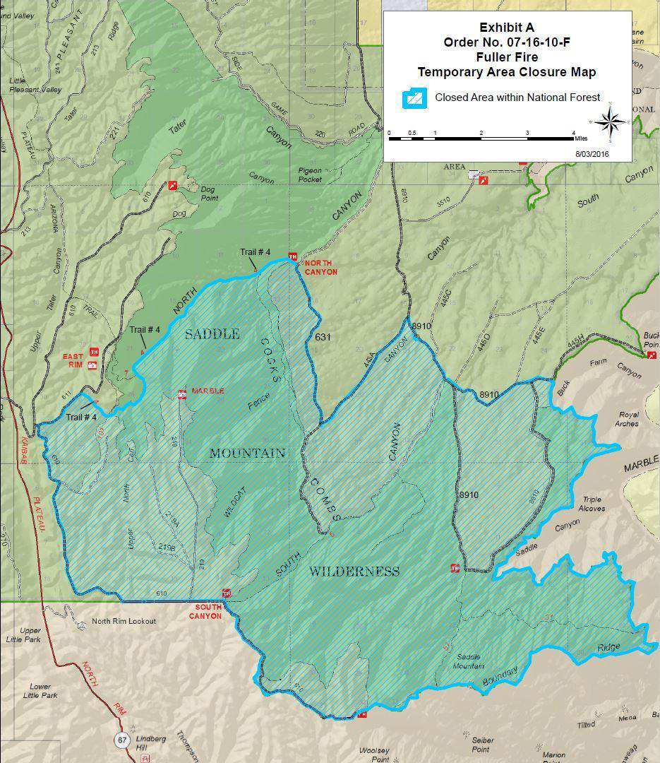
driving in the rain and be mindful of fire equipment on the roads. Fuels mitigation and road clean up will continue today. A new closure order is in place for the Kaibab National Forest. The boundary of this area closure starts east of Highway 67 at the junction of FR 610 and FR 611, heading northeast where
the junction of FR611 and the North Canyon Trail intersect, continuing on the North Canyon Trail to the trailhead on FR 631, then south on FR 631 to the junction with FR 445A, then northeast along FR 445A to the junction with FR 8910, then southeast along
FR8910 to the Forest boundary with Grand Canyon National Park and following this boundary south and west to FR 610 “This Order only affects National Forest System Lands.” For a map of the new closure, click
here. Fire Information:
Inciweb: inciweb.nwcg.gov/incident/4845
Text Message: text “follow GrandCanyonNPS” to 40404 Facebook: facebook.com/FullerFire
Twitter: twitter.com/GrandCanyonNPS
Fire Information Center: 844-684-5411 Recorded Information: 928-638-7688 http://wildlandfire.az.gov/links.asp#Smoke
This electronic message contains information generated by the USDA solely for the intended recipients. Any unauthorized interception of this message or the use or disclosure of the information it contains may violate the law and subject the violator to civil or criminal penalties. If you believe you have received this message in error, please notify the sender and delete the email immediately. To manage your subscription visit http://www.fs.fed.us/news/subscription.shtml |

Attachment:
1650-1_d3_Fuller Fire Update_2016_0804.pdf
Description: 1650-1_d3_Fuller Fire Update_2016_0804.pdf
Attachment:
Fuller Fire Closure Map_08-04-16.jpg
Description: Fuller Fire Closure Map_08-04-16.jpg
