|
U.S. Forest Service
News Release
Media Contact: Connie Birkland (928) 853-4617
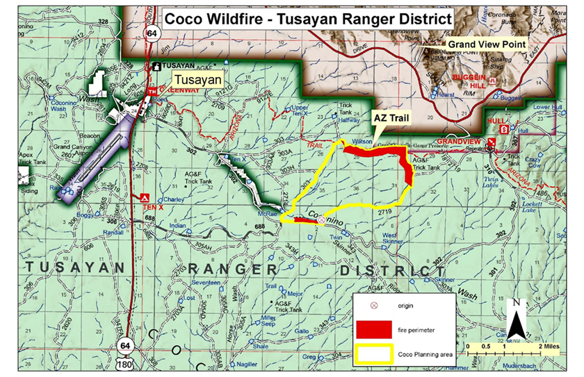
Tusayan, Ariz., July 28, 2016—For Immediate Release. The lightning-caused Coco Fire on the Tusayan Ranger District of the Kaibab National Forest has grown to 731 acres in size achieving resource objectives by reducing hazardous
fuel accumulations and restoring overall forest health. Fire crews worked late the previous shift completing management ignitions along Forest Road 2719 in order to keep the fire within planning area boundaries and protect fire sensitive archaeological sites. Smoke from the management ignitions
was transported west along Coconino Wash into the town of Tusayan resulting in moderate impacts in the early morning but will disperse throughout the day.
“We are very pleased with the fire progression and allowing fire to resume its role in the ecosystem. The natural mosaic of fire effects resulting from the fire growth enhances the heterogeneity and resilience of the forest” stated Incident
Commander Dan Pearson. The Arizona Trail remains open to hikers. As this lightning-caused fire continues to grow naturally, it is likely that smoke will remain visible from Highway 64, Grand Canyon National Park’s Desert View Drive, and other populated areas.
The current forecast predicts light and variable winds over the Coco Fire for the next several days which may result in more variable smoke dispersion until moisture moves into Northern Arizona this weekend. Coco Fire Overview: Start Date: July 22, 2016 For more information: ·
Inciweb: Coco Fire -
inciweb.nwcg.gov/incident/4881/
·
Kaibab National Forest Fire Information Phone Line (928) 635-8311
·
Text Message – text ‘follow kaibabnf’ to 40404 ·
Coco Fire Photo Album on Flickr:
bit.ly/CocoFirePhotos ·
Kaibab National Forest Twitter:
www.twitter.com/kaibabnf
·
Kaibab National Forest Website:
www.fs.usda.gov/kaibab
### Coco Fire Vicinity Map 7-28-16
This electronic message contains information generated by the USDA solely for the intended recipients. Any unauthorized interception of this message or the use or disclosure of the information it contains may violate the law and subject the violator to civil or criminal penalties. If you believe you have received this message in error, please notify the sender and delete the email immediately. To manage your subscription visit http://www.fs.fed.us/news/subscription.shtml |


Attachment:
1650-1_so_Coco_Fire_2016_0728-no_map.pdf
Description: 1650-1_so_Coco_Fire_2016_0728-no_map.pdf
