|
Point wildfire update
Sedona, Ariz., July 24, 2016, For Immediate Release — The lightning-caused Point Wildfire is currently burning
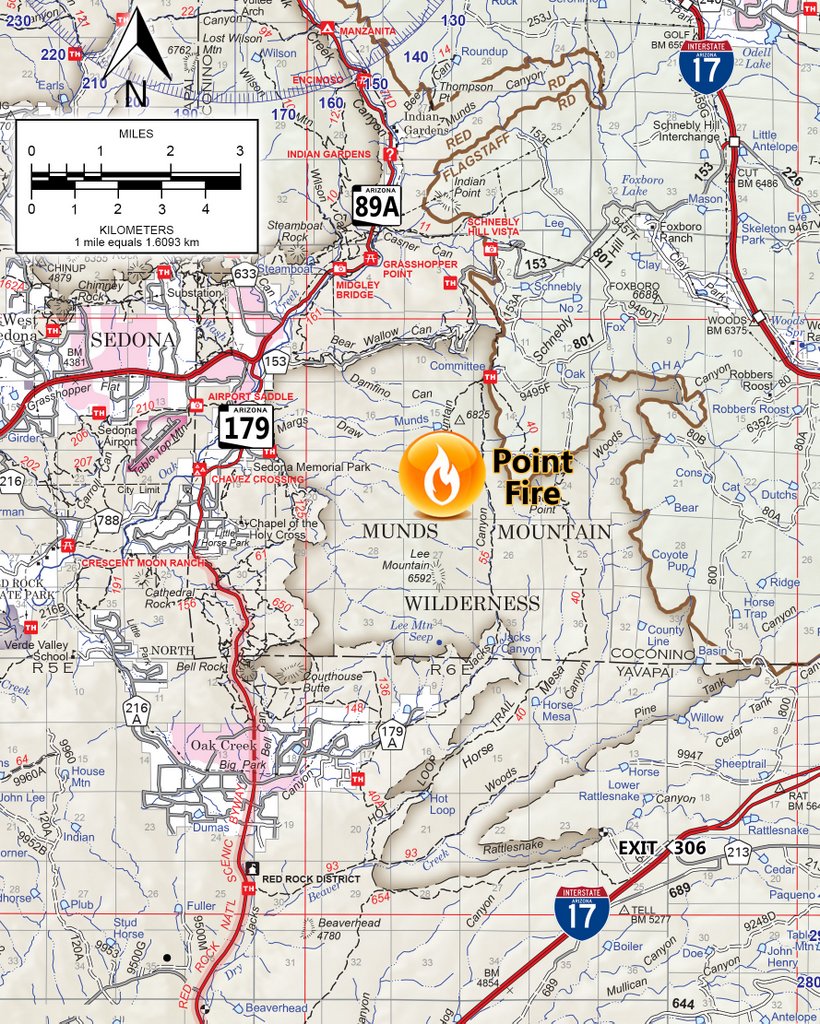
in Munds Mountain Wilderness on Munds mesa, which is located east of State Highway 179 and south of Sedona and Schnebly Hill road.
The fire is estimated at 190 acres and was ignited following several lighting storms that came through the area mid-week. “Today we are focusing on stopping the northern progression of the wildfire,” said Nicole Branton, Red Rock District ranger. “This fire is in very difficult
terrain that is dangerous to firefighting personnel, so we can expect to see smoke over the next several days as it continues to burn in areas that firefighters cannot access. Firefighter safety is our primary concern along with containing the fire on top
of the mesa to prevent further spread into surrounding canyons.” Smoke will also be visible from various parts of the Verde Valley and along Interstate 17 while firefighters work to contain the fire over the next few
days. Air attack helicopters and planes along with 55 firefighters are working to help slow progress across the mesa and to reduce its chance of moving into
side canyons. For public and fire fighter safety, the public is asked to acknowledge the closure area of Munds Mountain Trail and Jack Canyon trail are closed.
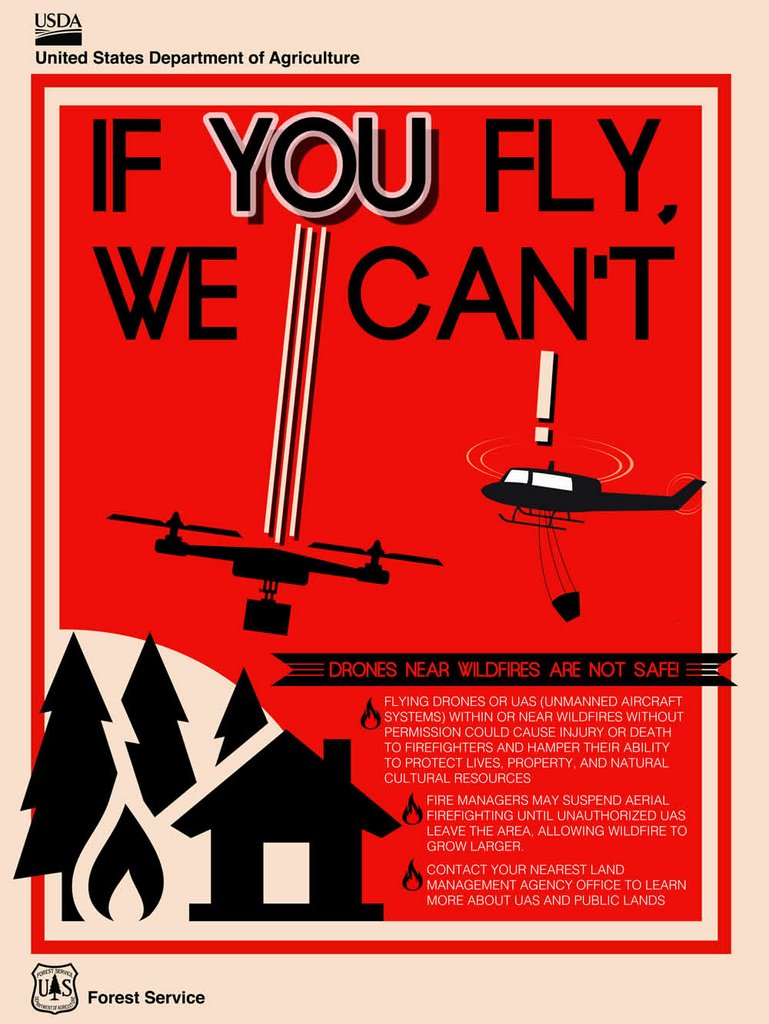
Drones cannot be flown over or near the fire, as doing so will cease operations that are fighting the fire with water drops from the air.
Current Size:
Approximately 190 acres Start Date:
July 20, 2016 Cause:
Lightning Location:
Munds Mountain Wilderness mesa, approximately 2.5 miles east/southeast of Sedona. Trails Closed to hikers: Munds Mountain Trail and Jacks Canyon Trail Resources:
One Type 1 Crew, two Fuels crews, 3 helicopters, 3 aircraft; Total of approximately 55 firefighters Public Updates: The public can get detailed updates as they become available at Inciweb at
http://inciweb.nwcg.gov/incident/4882/ . Follow us on Twitter for quick headline updates at
twitter.com/coconinonf. ###
This electronic message contains information generated by the USDA solely for the intended recipients. Any unauthorized interception of this message or the use or disclosure of the information it contains may violate the law and subject the violator to civil or criminal penalties. If you believe you have received this message in error, please notify the sender and delete the email immediately. To manage your subscription visit http://www.fs.fed.us/news/subscription.shtml |


Attachment:
Point Fire Location Map.jpg
Description: Point Fire Location Map.jpg
Attachment:
UAS_Fire_Safety.jpg
Description: UAS_Fire_Safety.jpg
