|
FIRE
News Release Kaibab National Forest
Grand Canyon National Park
For Immediate Release Contact:
USFS, Wade Ward, 928-308-0797 July 29, 2014 Contact:
NPS, Kirby-Lynn Shedlowski, 928-638-7958
Greater Grand Canyon Area Fires Update 07.29.14
WILLIAMS, Ariz. – With the return of monsoonal precipitation to all fires, growth and activity have
slowed. Crews continue to monitor the fires and do preparation work ahead of drier conditions forecasted to return mid-week. Smoke will be much lighter today and
tonight. Fire managers continue to coordinate with neighboring forests, national parks, municipal fire departments, and the Arizona Department of Environmental Quality to monitor smoke impacts. For more information on smoke and air quality please visit
www.azdeq.gov
or
wildlandfire.az.gov.
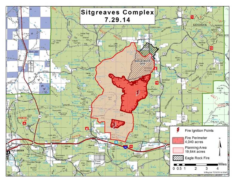
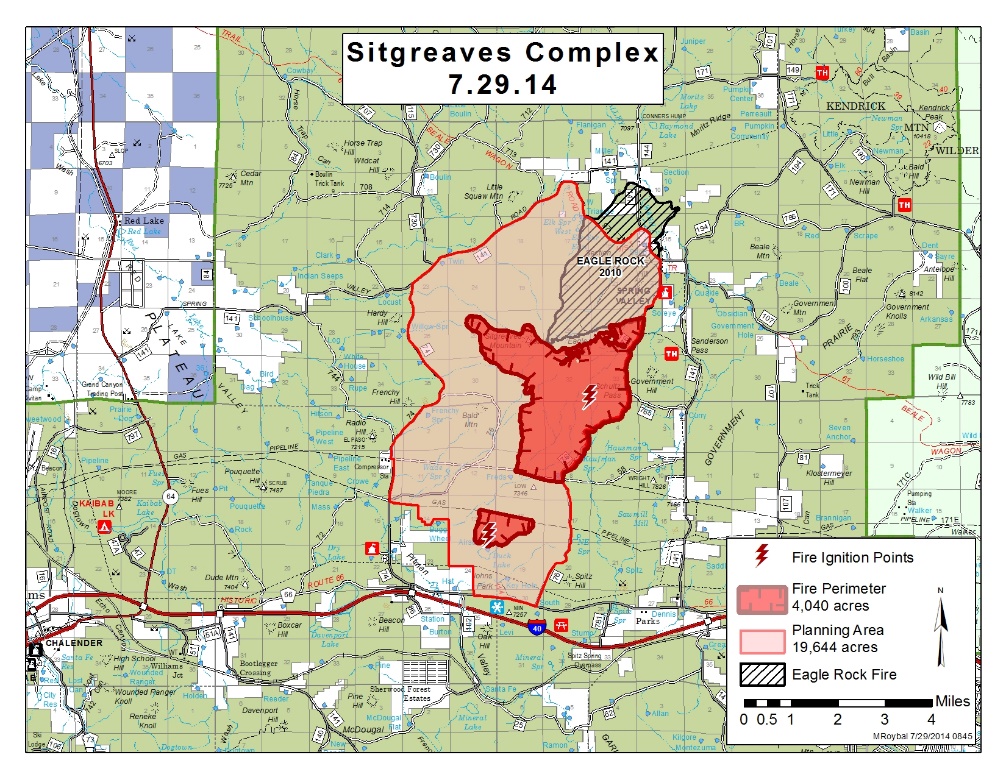
Williams Ranger District: Currently 4040 acres
in size, the Sitgreaves Complex
is located approximately 5 miles northwest of Parks, Ariz. Crews will monitor the fire and continue preparation work within the planning for future managed
ignitions. Smoke will continue to shift as monsoonal winds vary.
Tusayan Ranger District: Currently 3486 acres in
size, the McRae Fire
is located approximately 5 miles southeast of Tusayan, Ariz. The managed area received rain last night and throughout the day, so fire behavior is down
to creeping and smoldering. Crews will continue preparation for future ignitions within the planning area along Highway 64.
North Kaibab Ranger District: Currently 331 acres
in size, the Quaking Fire
is located approximately 40 miles southeast of Fredonia, Ariz. Plan for today and tomorrow is to begin chipping all slash removed during the prep phase
of the fire. Smoke is visible from the Rainbow Rim Trailhead and Highway 67.
North Rim Grand Canyon: Currently 303 acres in
size, the Kanabownits Fire is located approximately
1 mile northeast of the historic Kanabownits Cabin on the Walla Valley Peninsula. Today crews are continuing to monitor the fire and do preparation work. Smoke will continue to be visible as the fire smolders. Get fire activity updates and maps 24 hours-a-day:
Fire Information Line: 928-635-8311 (USFS) or 928-638-7819 (NPS) Inciweb:
inciweb.nwcg.gov
Text Message: text ‘follow kaibabnf’ to 40404 (USFS) or
@GrandCanyonNPS
on Twitter (NPS)
Jacqueline C. Banks Public Affairs Officer Kaibab National Forest Office: 928-635-8314 Cell: 928-606-7490 This electronic message contains information generated by the USDA solely for the intended recipients. Any unauthorized interception of this message or the use or disclosure of the information it contains may violate the law and subject the violator to civil or criminal penalties. If you believe you have received this message in error, please notify the sender and delete the email immediately. |
Attachment:
Current Update 7.29.14.pdf
Description: Current Update 7.29.14.pdf
