|
Please see today’s Mangum Fire update, map and smoke outlook from Southwest Incident Management Team #3.
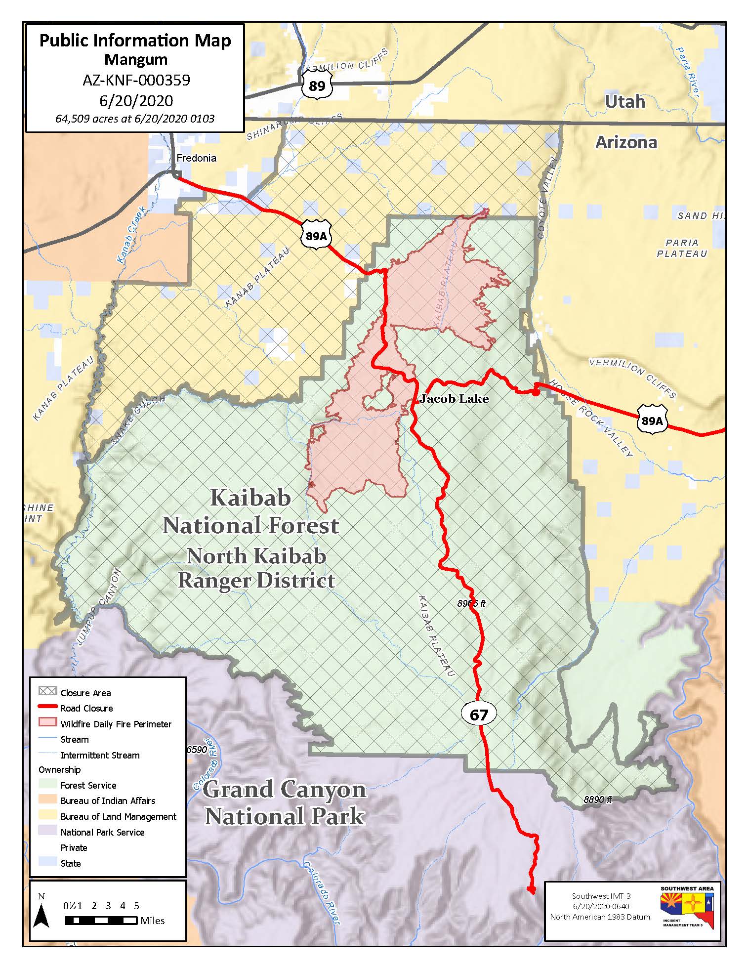
Due To More Accurate Mapping, Acreage Decreases
On Friday, favorable weather conditions aided firefighters in securing preliminary lines around critical areas of the fire. Firefighters focused their
efforts on the southern, western and eastern edges of the fire. Crews work towards containment through successful firing and burnout operations and additional line construction.
Northern sections of the fire remained slightly active. Firefighters continued to limit the fire’s spread to the north by securing anchor points and
constructing line. BLM’s Winter Road served as a firebreak and was enhanced by utilizing masticators to reduce the fuel load alongside the road, resulting in a wider firebreak.
Today’s weather forecast calls for westerly winds, hotter temperatures, and lower humidity. Fire behavior will be active with smoke blowing eastward.
Firefighters will continue to hold and secure fire lines and anchor points around various portions of the fire. Anticipate that fire may spread east towards House Rock area.
Closures: Highway 89A is closed from Mile Post 545 near
the Cliff Dwellings to Fredonia. Businesses remain open in Marble Canyon and Vermillion Cliffs. Highway 67 from Jacob Lake to the North Rim of Grand Canyon National Park is also closed. Due to the road closures, the North Rim of the Grand Canyon National
Park is presently inaccessible. The South Rim of the Grand Canyon National Park remains open. The U.S. Forest Service has closed the North Kaibab Ranger District. The Bureau of Land Management has also closed its lands east of Fredonia, both closures are for
public safety. See:
https://inciweb.nwcg.gov/incident.article/6748/52037/ Restrictions:
Kaibab National Forest has implemented Stage 2 Fire Restrictions. For a full list of prohibitions, please visit
https://www.fs.usda.gov/alerts/kaibab/alerts-notices/?aid=58061
Evacuations:
Jacob Lake and several residences along House Rock Road. Temporary Flight Restrictions: Temporary flight restrictions
(TFR) are in effect around the entire fire area. Remember, that temporary flight restrictions also apply to unmanned aircraft systems (drones). If you fly, we can’t! For further information, please visit the following links: Twitter:
@MangumFire Smoke Outlooks: https://fires.airfire.org/outlooks/NorthCentralArizona CDC Wildfire Smoke and COVID-19:
https://www.cdc.gov/coronavirus/2019-ncov/php/smoke-faq.html Mangum Fire Information Public Information: (602) 345-0469 For further information, please visit the following links |
Attachment:
062020MangumFireUpdatefinal.pdf
Description: 062020MangumFireUpdatefinal.pdf
Attachment:
2020-06-20-NorthCentralArizona-Outlook.20200620161325.pdf
Description: 2020-06-20-NorthCentralArizona-Outlook.20200620161325.pdf
Attachment:
PIO_WithTerrainLabels_85x11_Land_Mangum_AZKNF000369_0620_0640.jpg
Description: PIO_WithTerrainLabels_85x11_Land_Mangum_AZKNF000369_0620_0640.jpg
