
Firefighters continue operations on the Mogollon Rim
CLINTS WELL, Ariz., June 14, 2018, For Immediate Release — Firefighters have stopped forward
progress on the Tank Fire at approximately 170 acres in an area about 1-2 miles northeast of the junction of Lake Mary Road and state Route 87 on the Mogollon Rim.
Firefighters responded to five additional wildfires in the area ignited by thunderstorms moving across the Mogollon Rim yesterday afternoon.
The Tank Fire was the only fire in the area to show rapid growth. The other fires, ranging in size from a burning tree to 20 acres, are all contained this morning.
Motorists in the area of Lake Mary Road and state Route 87 should be cautious and aware of smoke impacts, low flying aircraft, as well as first responders and firefighter traffic.
Size: Estimated at 170 acres. Forward progress of the fire has stopped.
Containment: 0%.
Location: Approximately 1 mile north of Clints Well;
34°34'09.2"N 111°18'48.6"W.
Date Reported: June 13, 2018 at 12:30 p.m. by Coconino National Forest Baker Butte Lookout.
Cause: Lightning.
Current Resources: Three engines (comprised of Type III and VI), three Type I crews, two
water tender, three 10-person Type II crews and a dozer are assigned. Additionally, multiple types of aircraft are available if needed. Approximately 140 firefighting personnel are working this fire today.
Closures:
It is recommend for the public to avoid the area, and a temporary flight restriction is established over the area of the fire.
Smoke Impacts: Smoke is expected to impact Happy Jack, Clints Well, and the surrounding
area.
Evacuations:
Coconino County Sheriff’s Office has issued a pre-evacuation notice to private residences 3 miles north of Lake Mary Road and state Route 87, which includes Clear Creek Pines (Units 1 and 2). Evacuations
are handled by Coconino County, and more information about being prepared to evacuate can be found online at
http://www.coconino.az.gov/207/Emergency-Management.
Structures Threatened:
Approximately 100.
Injuries:
None reported.
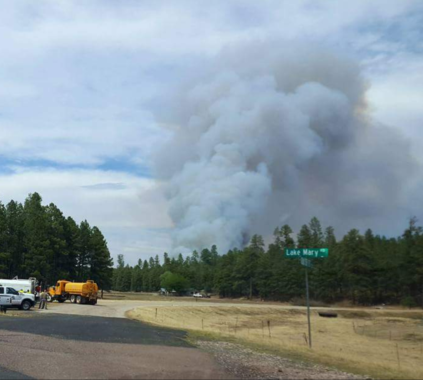
Photo credit: U.S. Forest Service
Caption: Smoke rises from the Tank Fire at the Intersection of lake Mary Road and state Route 87 near Clints Well, Ariz.
###
|

|
|
George F. Jozens
Deputy Public Affairs Officer
|
|
Forest Service
Coconino National Forest, Supervisors Office
|
|
p: 928-527-3412
gjozens@xxxxxxxxx
|
|
1924 S. Thompson St
Flagstaff, AZ 86001
www.fs.fed.us
  
|
|
Caring for the land and serving people
|
|
