Prescribed burns planned for next week
FLAGSTAFF, Ariz., April 13, 2018, For Immediate Release —
Coconino National Forest fire
managers have planned several prescribed burns next week throughout the forest due to predicted favorable weather and wind conditions. These burns could be cancelled or postponed if conditions
change.
FLAGSTAFF RANGER DISTRICT.
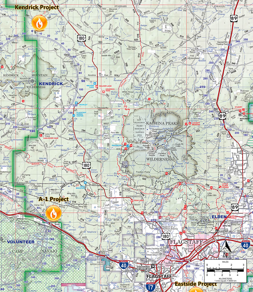
A1 Mountain Project
When:
Planned ignition will be Tuesday and Wednesday (April 17, 18). Ignitions typically begin around 8 a.m.
Where: Immediately east of
Bellemont, ½ mile north of Interstate 40 and ½ mile east of Pilot Travel Center. (35°14'47.9"N
111°48'53.9"W)
Size: 490 acres.
Closures/Restrictions:
None expected.
Smoke Impacts:
Smoke is predicted to move toward the east/northeast and may be seen by motorists on I 40 and by residents of Bellemont. Smoke may settle in
the local area, local canyons and will drain to lower elevations in the I-40 corridor during the cooler evening hours and Wednesday morning. It is predicted to disperse by the following afternoon.
Kendrick Burn Project
When:
Planned ground ignitions will be Wednesday (April 18).
Where: Twenty miles northwest of Flagstaff, 4 miles north of Kendrick Mountain. (35°27'52.6"N
111°50'35.0"W)
Size:
503 acres.
Closures/Restrictions: None expected.
Smoke Impacts: Smoke may be seen by motorists on U.S. Highway
180 north of Flagstaff during the day. Cooling temperatures in the evenings may cause smoke to settle and drain down nearby canyons and low lying areas. Smoke will likely appear thicker the morning after the burn as it settles overnight and should dissipate
by early the next afternoon.
MOGOLLON RIM RANGER DISTRICT.
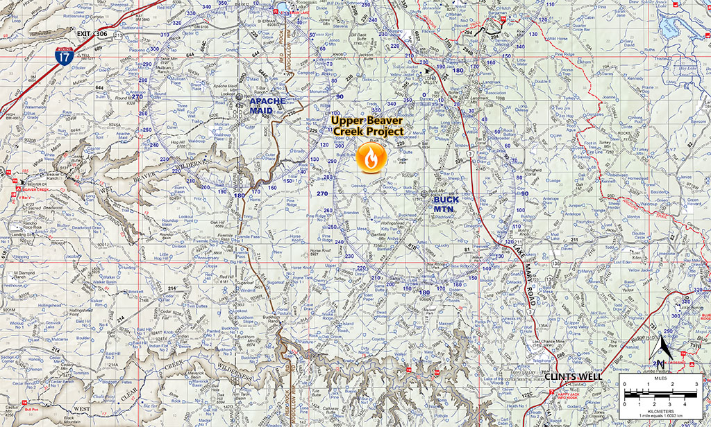
Upper Beaver Creek Project (Buck Mountain area)
When:
Planned ground ignitions are Tuesday through Thursday (April 17 to 19), with ground and aerial ignitions. Ignitions will begin around 9 a.m.
and the duration of this project will be approximately three days.
Where: Approximately 22 miles east of Montezuma’s Castle National Monument and near Buck Mountain Lookout (34°41'58.2"N
111°26'45.4"W).
This prescribed burn will be conducted across Buck Mountain, Buck Butte and further west outside of Wet Beaver Wilderness.
Size: 5,500 acres in total,
broken into manageable blocks each day.
Closures/Restrictions:
None.
Smoke Impacts:
Smoke is predicted to move toward the east/northeast and may impact Mormon Lake communities to the north and the Discovery Channel Telescope
to the east. Smoke may be seen from Lake Mary Road and I 17. Cooling temperatures in the evenings may cause smoke to settle and drain down nearby canyons, Beaver Creek, West Clear Creek, the Verde Valley and possibly impact the Village of Oak Creek.
Prescribed burns are always
dependent upon weather and wind conditions, as well as approval from Arizona Department of Environmental Quality (ADEQ).
The public can view approved prescribed burns on ADEQ’s website at smoke.azdeq.gov. Burns on the Coconino National Forest begin with the forest’s designator “COF.”
Notifications of upcoming prescribed
burns are provided
regularly by news releases throughout the season and also by the following online resources:
·
Sign up to receive news releases from Coconino NF:
www.fs.fed.us/news/subscription.shtml
·
Coconino NF’s Inciweb page:
http://inciweb.nwcg.gov/
·
Coconino NF’s Twitter account:
www.twitter.com/CoconinoNF
·
Coconino NF public website:
www.coconinonationalforest.us
·
Coconino NF’s Facebook page:
www.facebook.com/coconinonf
###
|

|
|
George F. Jozens
Deputy Public Affairs Officer
|
|
Forest Service
Coconino National Forest, Supervisors Office
|
|
p: 928-527-3412
gjozens@xxxxxxxxx
|
|
1924 S. Thompson St
Flagstaff, AZ 86001
www.fs.fed.us
  
|
|
Caring for the land and serving people
|
|


