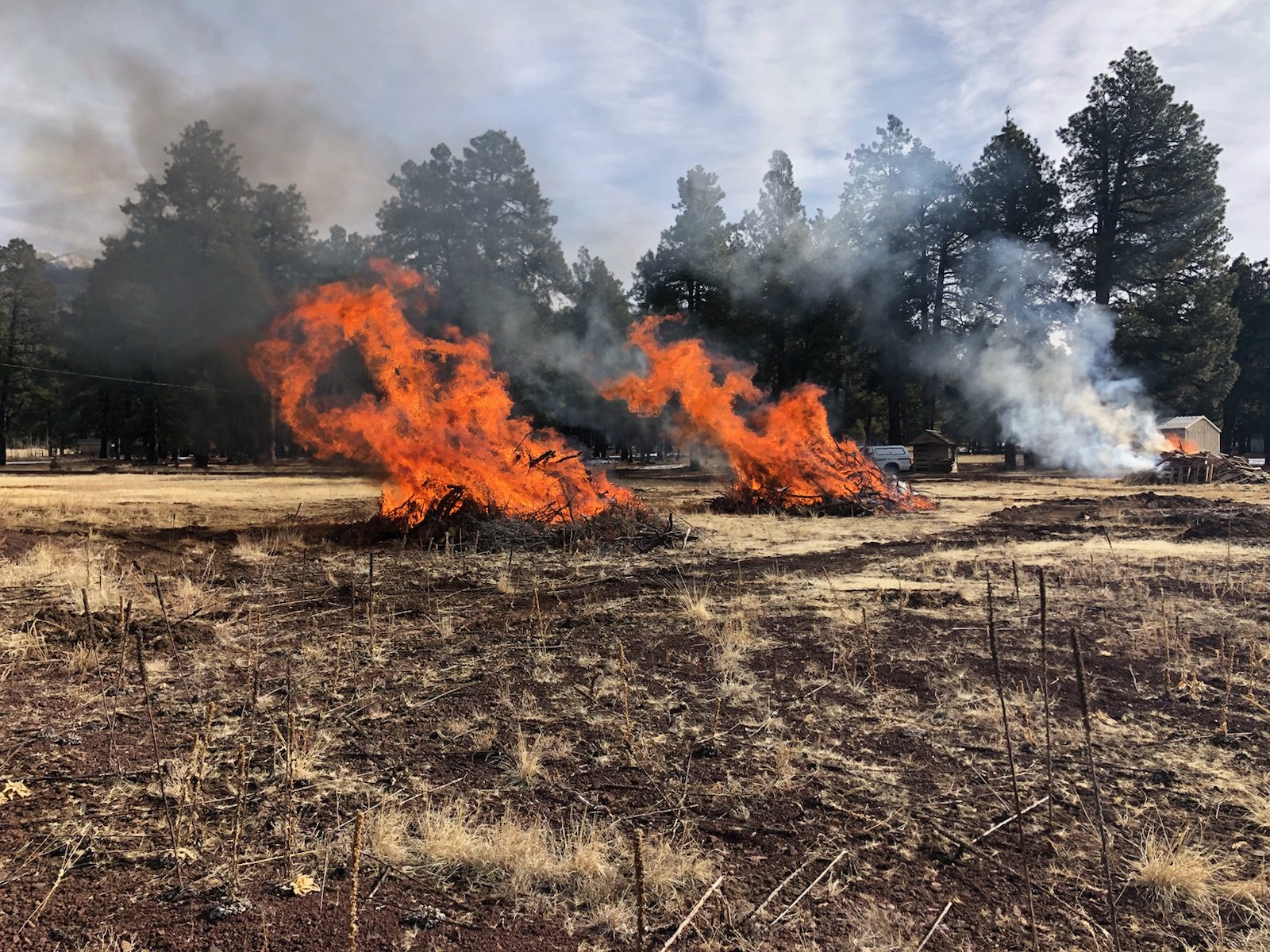
Prescribed burn today, later this week
FLAGSTAFF, Ariz., March 5, 2018, For Immediate Release —
With snow passing through the Coconino National Forest last week fire managers have burned slash piles today on the Flagstaff Hotshot Ranch near Snowbowl ski area and later in the week
southwest of Stoneman Lake and northeast of the Blue Ridge Community.
Three small piles built by hand were burned today near Snowbowl road south of Flagstaff. Smoke from the pile burn is expected to be
insignificant and unnoticed except by people in the immediate area.
Prescribed burns are planned by both the Red Rock Ranger District and the Mogollon Rim
Ranger District in grassland areas Thursday and Friday. Smoke will be minimal and disperse to the east and northeast with the forecast
winds.
FLAGSTAFF RANGER DISTRICT.
Flagstaff Hotshot Ranch Piles
When:
Planned ignition was today (March 5) at approximately 9:30 a.m. and piles will burn and be monitored for several hours.
Where:
The burn area is approximately 6 miles northeast of Flagstaff, below the San Francisco Peaks just off Snowbowl Road (35°17'13.7"N,
111°43'28.6"W)
Size:
Approximately 1 acre, consisting of three piles.
Closures/Restrictions:
None.
Smoke Impacts:
Smoke is minimal, may be noticed if driving on Snowbowl Road.
RED ROCK RANGER DISTRICT.
Cedar Flats Project
When:
Planned ignition is Thursday or Friday (March 8 or 9) at approximately 9:30 a.m. The estimated duration of this project is one day.
Where:
The burn area is approximately 14 miles southwest of Stoneman Lake
(34°36'6.21"N,
111°36'58.51"W)
Size:
Approximately a 300-acre grassland broadcast burn.
Closures/Restrictions:
None.
Smoke Impacts:
Smoke will be minimal, may be noticed if driving in the immediate vicinity.
MOGOLLON RIM RANGER DISTRICT.
Bar T Bar Ranch Project
When:
Planned ignition is Friday (March 9) or next week dependent upon fuel moisture and weather. Most prescribed burn ignitions begin around 9:30
a.m. The estimated duration of this project is one day.
Where:
The burn area is approximately 1.5 miles southeast of state Route 87 and 7 miles northeast of the Blue Ridge Community. (34°44'23.67"N,
110°59'57.03"W)
Size:
Approximately a 100-acre grasslands broadcast burn.
Closures/Restrictions:
None.
Smoke Impacts:
Smoke will be minimal and may be noticed if driving on state Route 87.
Prescribed burns are always
dependent upon approval from Arizona Department of Environmental Quality (ADEQ), weather and wind conditions, this burn could be canceled if conditions are not suitable.
The public can view approved prescribed burns on ADEQ’s website at smoke.azdeq.gov. Burns on the Coconino National Forest begins with the forest’s
designator “COF.”
Notifications of upcoming burn events are provided regularly by news releases and by the
following online resources:
·
Inciweb:
http://inciweb.nwcg.gov/unit/303/
·
Twitter:
www.twitter.com/CoconinoNF
·
Coconino website:
www.coconinonationalforest.us,
(Under News and Events)
·
Sign up to receive news releases:
www.fs.fed.us/news/subscription.shtml
###
|

|
|
George F. Jozens
Deputy Public Affairs Officer
|
|
Forest Service
Coconino National Forest, Supervisors Office
|
|
p: 928-527-3412
gjozens@xxxxxxxxx
|
|
1924 S. Thompson St
Flagstaff, AZ 86001
www.fs.fed.us
  
|
|
Caring for the land and serving people
|
|

