|
CORRECTED NEWS RELEASE. Please delete previous versions of this news release. Apologies, but there were some slight edits that needed to be made. Thank you, Jackie
Kaibab National Forest maps trails as part of topographical initiative Williams, Ariz., Aug. 2, 2017—For Immediate Release. The Kaibab National Forest has taken on a major trail mapping project as part of a larger
Forest Service topographical initiative aimed at producing new and more accurate maps for employee and public use. Throughout the summer, employees and interns have been re-mapping miles upon miles of trails across the 1.6-million-acre Kaibab National Forest by hiking each and every one of them. On a typical day,
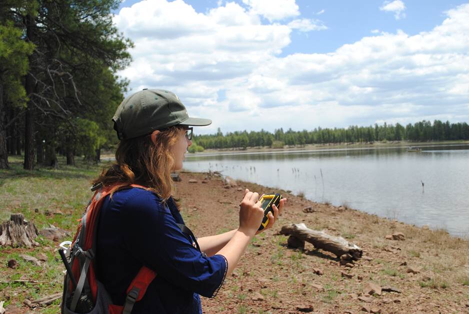
recreation intern Mary Bielamowicz and geographic information systems intern Michelle Barton grab their tablets loaded with the ArcGIS Collector app, a mapping and spatial data analysis application, and select a trail to hike. The tablets have a GPS chip,
so even when they are offline, they can map trails that are far from any Wi-Fi signal.
Once they are on the trail, they map the beginning mile point, ending mile point, note maintenance needs and issues along the route, and take photos of signs or any other special features. When other
employees map trails, they follow the same process. The Collector app syncs back to ArcGIS Online. ArcGIS Online is cloud-based, which means that everyone on the system can see what others have mapped, what specific information has been gathered, and what
trails still require attention. This allows for an organized, consistent process that will result in updated, high-quality data that can eventually be shared with other employees and members of the public.
The Forest Service is putting focus to the topographical initiative because many of the agency’s maps are based on outdated U.S. Geological Survey topographic maps, so there are inconsistencies and
errors in the data. “When you’re out there, even when you’re an experienced hiker, you want to know where you’re hiking,” Bielamowicz said.
Alongside visitor safety, accurate trail mapping also contributes to firefighter and other Forest Service employee safety. For example, if a fire crew needs to leave an area quickly, they have to
know which trail will be fastest, or which will lead them to their next location.
The creation of new topographic maps includes re-mapping trails and streams, taking more high-quality aerial photos, and making more exact digital elevation models. This larger, coordinated effort
to upgrade topographic data and map products, which is being led by the Forest Service Southwestern Regional Office, will eventually provide for better visitor experiences, improved safety, and more precise management decisions on the Kaibab National Forest.
Topographic maps remain indispensable tools for everyday use in government, science, industry, land management planning and recreation. “What we will be able to say is that in 2017, we had new trail maps, new hydrologic data, and new resource photography,” said Mark Christiano, geographic information systems coordinator for the Kaibab
National Forest. “Better data will lead to more informed decisions, and that’s why this initiative is so important.”
Follow the Kaibab National Forest on Facebook and Twitter @KaibabNF.
###
Recreation intern Mary Bielamowicz maps a trail near a lake on the Williams Ranger District. Photo by Allison Borzoni. Credit Kaibab National Forest. This electronic message contains information generated by the USDA solely for the intended recipients. Any unauthorized interception of this message or the use or disclosure of the information it contains may violate the law and subject the violator to civil or criminal penalties. If you believe you have received this message in error, please notify the sender and delete the email immediately. To manage your subscription visit http://www.fs.fed.us/news/subscription.shtml |
Attachment:
1650-1_so_MappingProject_2017_0802.pdf
Description: 1650-1_so_MappingProject_2017_0802.pdf


